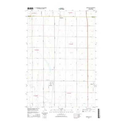
2015 Map of Northville
USGS Topo · Published 2015About this map
Northville and Mellette anchor this section of the Glacial Lake Dakota plain in Spink County, where the landscape is defined by a rigid section-line road grid and the meandering path of Snake Creek. This 2015 U.S. Geological Survey representation details the small-town layout of Northville, including its core streets like Main St and Elm St, situated just south of Fairview Cem. To the north, the small settlement of Mansfield sits on the border with Brown County, illustrating the sparse but deliberate distribution of communities in this agricultural region.
Find a feature on this map
37 named features on this map. Tap any name to fly to it.
Don’t see what you’re looking for? This feature index may not catch every label — zoom into the map to look around manually.
Map Details
Editions of this 2015 Northville Map
This is the sole edition of this map. No revisions or reprints were ever made.
Other maps of this area

1895 · Aberdeen
USGS Topo · 1:125,000

1899 · Northville
USGS Topo · 1:125,000

1953 · Gallup
USGS Topo · 1:24,000

1953 · Warner
USGS Topo · 1:24,000

1954 · Mellette
USGS Topo · 1:24,000

1954 · Aberdeen
USGS Topo · 1:250,000

1956 · Aberdeen
USGS Topo · 1:250,000

1960 · Rudolph
USGS Topo · 1:24,000
1960 · Northville
USGS Topo · 1:24,000
1960 · Athol
USGS Topo · 1:24,000