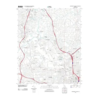
2011 Map of Northwest Atlanta
USGS Topo · Published 2011About this map
Chattahoochee River curves through this 2011 survey, marking the northwestern edge of a landscape where industrial infrastructure and historic residential districts converge. The massive rail operations at Inman Yard and Bellwood Yard dominate the central corridor, signaling the city's enduring role as a transportation hub. In the southeast, the urban fabric of downtown and midtown emerges, featuring landmarks such as the Georgia Institute of Technology, Georgia State University, and Underground Atlanta.
Find a feature on this map
117 named features on this map. Tap any name to fly to it.
Don’t see what you’re looking for? This feature index may not catch every label — zoom into the map to look around manually.
Map Details
Editions of this 2011 Northwest Atlanta Map
This is the sole edition of this map. No revisions or reprints were ever made.
Other maps of this area

1888 · Atlanta
USGS Topo · 1:125,000

1890 · Atlanta
USGS Topo · 1:125,000

1891 · Marietta
USGS Topo · 1:125,000

1892 · Atlanta
USGS Topo · 1:125,000

1895 · Atlanta
USGS Topo · 1:125,000

1895 · Marietta
USGS Topo · 1:125,000

1897 · Marietta
USGS Topo · 1:125,000

1901 · Marietta
USGS Topo · 1:125,000

1953 · Atlanta
USGS Topo · 1:250,000

1954 · Conley
USGS Topo · 1:24,000