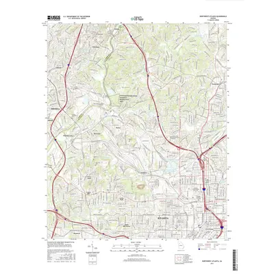
2017 Map of Northwest Atlanta
USGS Topo · Published 2017About this map
Atlanta and its northern suburbs are meticulously detailed in this 2017 survey, revealing a landscape where dense urban development meets the significant topography of Mt Wilkinson and the Chattahoochee River. The map provides an essential resource for tracing local history through its numerous burial grounds, including the large Crestlawn Cem and Hollywood Cem. Education and infrastructure anchors like the Georgia Institute of Technology and the Atlanta City Water Works Reservoir Number One define the city's interior, while the Chattahoochee River National Recreation Area preserves green space along the waterway.
Find a feature on this map
407 named features on this map. Tap any name to fly to it.
Don’t see what you’re looking for? This feature index may not catch every label — zoom into the map to look around manually.
Map Details
Editions of this 2017 Northwest Atlanta Map
This is the sole edition of this map. No revisions or reprints were ever made.
Other maps of this area

1888 · Atlanta
USGS Topo · 1:125,000

1890 · Atlanta
USGS Topo · 1:125,000

1891 · Marietta
USGS Topo · 1:125,000

1892 · Atlanta
USGS Topo · 1:125,000

1895 · Atlanta
USGS Topo · 1:125,000

1895 · Marietta
USGS Topo · 1:125,000

1897 · Marietta
USGS Topo · 1:125,000

1901 · Marietta
USGS Topo · 1:125,000

1953 · Atlanta
USGS Topo · 1:250,000

1954 · Conley
USGS Topo · 1:24,000