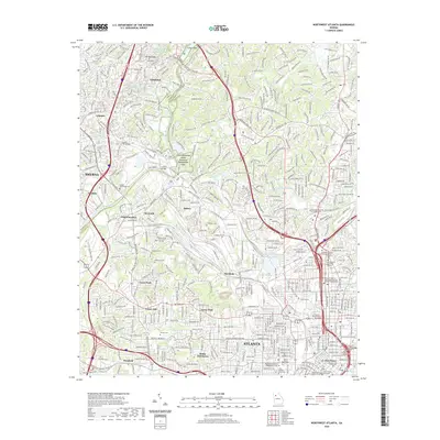
2020 Map of Northwest Atlanta
USGS Topo · Published 2020About this map
The Chattahoochee River National Recreation Area forms a major corridor through this landscape, dividing the urbanized core of Atlanta from suburban developments in Vinings and Smyrna. The map captures a high-density institutional landscape, featuring major academic campuses such as the Georgia Institute of Technology and Georgia State University, alongside civic landmarks like the Fulton County Courthouse near Five Points. The transition from the dense downtown grid to the residential neighborhoods of Grove Park and Carey Park is marked by expansive cemetery tracts, including Hollywood Cem and Crestlawn Cem. Infrastructure such as the Atlanta City Water Works Reservoir Number Two and the CSX rail lines underscores the area's role as a regional hub for utility and transport in the modern era.
Find a feature on this map
75 named features on this map. Tap any name to fly to it.
Don’t see what you’re looking for? This feature index may not catch every label — zoom into the map to look around manually.
Map Details
Editions of this 2020 Northwest Atlanta Map
This is the sole edition of this map. No revisions or reprints were ever made.
Other maps of this area

1888 · Atlanta
USGS Topo · 1:125,000

1890 · Atlanta
USGS Topo · 1:125,000

1891 · Marietta
USGS Topo · 1:125,000

1892 · Atlanta
USGS Topo · 1:125,000

1895 · Atlanta
USGS Topo · 1:125,000

1895 · Marietta
USGS Topo · 1:125,000

1897 · Marietta
USGS Topo · 1:125,000

1901 · Marietta
USGS Topo · 1:125,000

1953 · Atlanta
USGS Topo · 1:250,000

1954 · Conley
USGS Topo · 1:24,000