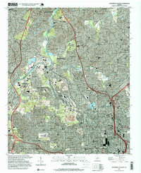
1997 Map of Northwest Atlanta
USGS Topo · Published 1999About this map
The Chattahoochee River carves a dividing line between Cobb and Fulton Counties in this late-nineties landscape, where industrial infrastructure meets established residential neighborhoods. The sprawling Inman Yard rail complex dominates the central corridor, signaling the area's role as a transportation hub, while the massive Lincoln Cemetery and Crestlawn serve as significant local landmarks. In the urban core of Atlanta, the presence of the Georgia Institute of Technology and the Georgia Dome reflect a modernizing cityscape. Educational institutions are densely packed throughout the quadrangle, ranging from The Lovett Sch in the north to Frederick Douglas High Sch in the south. Natural pockets persist amidst the development, including the Chattahoochee River National Recreational Area and Atlanta Memorial Park, showing the effort to preserve green space as the metropolitan area expanded.
Find a feature on this map
80 named features on this map. Tap any name to fly to it.
Don’t see what you’re looking for? This feature index may not catch every label — zoom into the map to look around manually.
Map Details
Editions of this 1997 Northwest Atlanta Map
This is the sole edition of this map. No revisions or reprints were ever made.
Other maps of this area

1888 · Atlanta
USGS Topo · 1:125,000

1890 · Atlanta
USGS Topo · 1:125,000

1891 · Marietta
USGS Topo · 1:125,000

1892 · Atlanta
USGS Topo · 1:125,000

1895 · Atlanta
USGS Topo · 1:125,000

1895 · Marietta
USGS Topo · 1:125,000

1897 · Marietta
USGS Topo · 1:125,000

1901 · Marietta
USGS Topo · 1:125,000

1953 · Atlanta
USGS Topo · 1:250,000

1954 · Conley
USGS Topo · 1:24,000