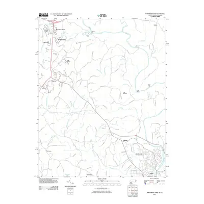
2011 Map of Northwest Eden
USGS Topo · Published 2011About this map
The Smith River carves a winding path through the borderlands of North Carolina and Virginia, defining the landscape of northern Eden and its surrounding communities. This 2011 survey captures the residential growth and naming conventions of the modern era, from established neighborhoods like Marrowbone Heights and Sheffield Terrace in the northwest to Hamilton Hills in the southeast. The geography is deeply influenced by the river's hydrology, featuring a sharp meander known as The Bend and several historic crossing points including Egglestons Ford, Long Island Ford, and Break Reed Ford.
Find a feature on this map
128 named features on this map. Tap any name to fly to it.
Don’t see what you’re looking for? This feature index may not catch every label — zoom into the map to look around manually.
Map Details
Editions of this 2011 Northwest Eden Map
This is the sole edition of this map. No revisions or reprints were ever made.
Other maps of this area

1924 · Martinsville
USGS Topo · 1:48,000

1924 · Draper
USGS Topo · 1:48,000

1926 · Martinsville
USGS Topo · 1:62,500

1926 · Draper
USGS Topo · 1:62,500

1927 · Martinsville
USGS Topo · 1:62,500

1944 · Martinsville
USGS Topo · 1:62,500

1944 · Draper
USGS Topo · 1:62,500

1953 · Greensboro
USGS Topo · 1:250,000

1954 · Greensboro
USGS Topo · 1:250,000

1962 · Greensboro
USGS Topo · 1:250,000