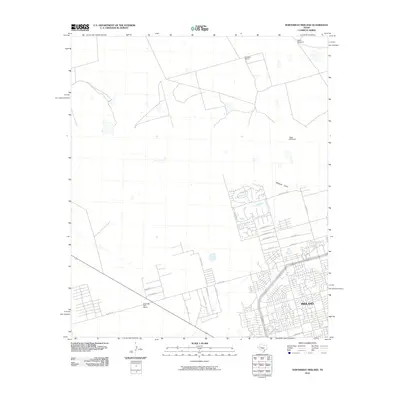
2010 Map of Northwest Midland
USGS Topo · Published 2010About this map
The Midland city limits expand into the High Plains on this map, where residential street grids meet traditional Texas ranchlands. Significant development is visible in the southeastern quadrant, featuring neighborhood clusters such as Island Cir and streets named for birds like Robin Ln and Cardinal Ln. This suburban growth sits adjacent to Midland Draw, which cuts through the landscape just north of Greentree Blvd. Further north and west, the terrain remains largely open, marked by isolated points of infrastructure like North Windmill and West Windmill. Larger landholdings such as Cowden Ranch and the High Sky Girls Ranch illustrate the area's transition from cattle country to a modern energy and residential hub. The network of county roads, including N Co Rd 1243 and W Co Rd 60, provides a framework for the ongoing expansion of this Permian Basin community.
Find a feature on this map
27 named features on this map. Tap any name to fly to it.
Don’t see what you’re looking for? This feature index may not catch every label — zoom into the map to look around manually.
Map Details
Editions of this 2010 Northwest Midland Map
This is the sole edition of this map. No revisions or reprints were ever made.
Other maps of this area

1954 · Hobbs
USGS Topo · 1:250,000

1954 · Pecos
USGS Topo · 1:250,000

1957 · Pecos
USGS Topo · 1:250,000

1958 · Hobbs
USGS Topo · 1:250,000

1964 · Odessa NE
USGS Topo · 1:24,000

1965 · Southeast Midland
USGS Topo · 1:24,000

1965 · Southwest Midland
USGS Topo · 1:24,000

1965 · Northeast Midland
USGS Topo · 1:24,000

1966 · Mabee Ranch
USGS Topo · 1:24,000

1966 · North Curtis Ranch
USGS Topo · 1:24,000