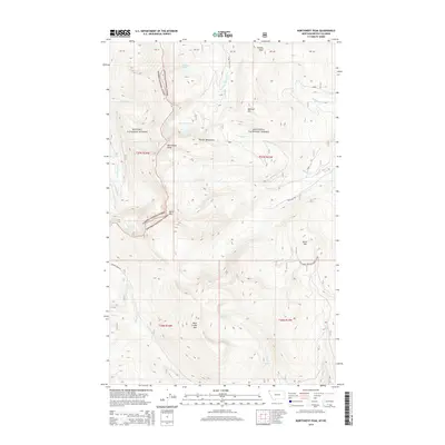
2014 Map of Northwest Peak
USGS Topo · Published 2014About this map
Northwest Peak stands as the central landmark in this high-altitude section of the Purcell Mountains, marking a dramatic intersection of the Kanisku National Forest and Kootenai National Forest. The landscape is defined by its complex drainage systems and alpine basins, where Hawkins Lakes and Burke Lake feed into tributaries such as the S Fork Hawkins Cr and Aster Cr. In the southern reaches, the elevation rises toward Rock Candy Mtn and Black Top, overlooking the deep basin of Lake Florence.
Find a feature on this map
31 named features on this map. Tap any name to fly to it.
Don’t see what you’re looking for? This feature index may not catch every label — zoom into the map to look around manually.
Map Details
Editions of this 2014 Northwest Peak Map
This is the sole edition of this map. No revisions or reprints were ever made.
Other maps of this area

1911 · Priest Lake
USGS Topo · 1:250,000

1913 · Priest Lake
USGS Topo · 1:250,000

1957 · Kalispell
USGS Topo · 1:250,000

1958 · Sandpoint
USGS Topo · 1:250,000

1960 · Kalispell
USGS Topo · 1:250,000

1961 · Kalispell
USGS Topo · 1:250,000

1963 · Sandpoint
USGS Topo · 1:250,000

1963 · Mount Baldy
USGS Topo · 1:24,000

1963 · Northwest Peak
USGS Topo · 1:24,000

1963 · Garver Mountain
USGS Topo · 1:24,000