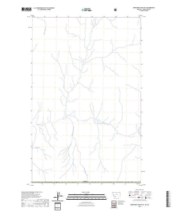
2024 Map of Northwest Peak OE N
USGS Topo · Published 2024About this map
Canada forms the southern boundary of this remote northern landscape, where the primary topographic features are defined by the intricate dendritic drainage of the Upper Yaak River basin. The map area is dominated by the headwaters of Hawkins Creek and its major tributary, South Hawkins Creek, which carve through the high terrain of Lincoln County. This 2024 survey captures a wilderness area largely devoid of modern development, emphasizing the natural hydrology of the Kootenai National Forest region. Smaller drainages like Manson Creek in the northwest and Cold Creek in the southwest contribute to the complex watershed that flows southward from the international border. The survey also identifies several Public Land Survey System parcels, including PB 38 and PB 42, which sit just north of the border line within t37n r34w.
Find a feature on this map
12 named features on this map. Tap any name to fly to it.
Don’t see what you’re looking for? This feature index may not catch every label — zoom into the map to look around manually.
Map Details
Editions of this 2024 Northwest Peak OE N Map
This is the sole edition of this map. No revisions or reprints were ever made.
Other maps of this area

1911 · Priest Lake
USGS Topo · 1:250,000

1913 · Priest Lake
USGS Topo · 1:250,000

1957 · Kalispell
USGS Topo · 1:250,000

1958 · Sandpoint
USGS Topo · 1:250,000

1960 · Kalispell
USGS Topo · 1:250,000

1961 · Kalispell
USGS Topo · 1:250,000

1963 · Sandpoint
USGS Topo · 1:250,000

1963 · Northwest Peak
USGS Topo · 1:24,000

1963 · Garver Mountain
USGS Topo · 1:24,000
1965 · Canuck Peak
USGS Topo · 1:24,000