
1980 Map of Northwest Pontotoc
USGS Topo · Published 1981About this map
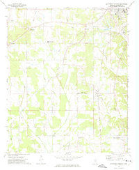
Lappatubby Creek and the Illinois Central Gulf railroad corridor anchor this landscape of the Mississippi hill country in the mid-1970s. The northern portion of the sheet is dominated by the town of Ecru, where the North Pontotoc Attendance Center and various industrial features indicate a settled community hub. Moving south toward the northern edge of Pontotoc, the map reveals a series of smaller rural nodes like Hortontown, Possum Trot, and Buchannan.
Find a feature on this map
37 named features on this map. Tap any name to fly to it.
Don’t see what you’re looking for? This feature index may not catch every label — zoom into the map to look around manually.
Map Details
Editions of this 1980 Northwest Pontotoc Map
This is the sole edition of this map. No revisions or reprints were ever made.
Other maps of this area

1949 · New Albany
USGS Topo · 1:62,500

1951 · New Albany
USGS Topo · 1:62,500

1955 · Sherman
USGS Topo · 1:62,500

1956 · Tupelo
USGS Topo · 1:250,000

1958 · Tupelo
USGS Topo · 1:250,000

1966 · Troy NW
USGS Topo · 1:24,000

1972 · Randolph
USGS Topo · 1:24,000
1972 · Southwest Pontotoc
USGS Topo · 1:24,000
1980 · Thaxton
USGS Topo · 1:24,000

1980 · New Albany West
USGS Topo · 1:24,000