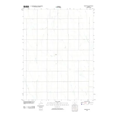
2009 Map of Norton NE
USGS Topo · Published 2009About this map
Sheley Cemetery sits near the center of this rural landscape in Norton County, reflecting the long-standing agricultural roots of the region. The terrain is defined by the winding course of the North Fork Prairie Dog Creek as it moves through the eastern portion of the quadrangle, joined by smaller tributaries like Spring Branch. A strictly organized grid of local roads, such as RD E 4 and RD C, provides access to the surrounding farmsteads and fields. This 2009 survey by the U.S. Geological Survey captures a snapshot of the High Plains before modern developments might have altered these traditional section lines and watercourses.
Find a feature on this map
15 named features on this map. Tap any name to fly to it.
Don’t see what you’re looking for? This feature index may not catch every label — zoom into the map to look around manually.
Map Details
Editions of this 2009 Norton NE Map
This is the sole edition of this map. No revisions or reprints were ever made.
Other maps of this area

1893 · Norton
USGS Topo · 1:125,000

1896 · Arapahoe
USGS Topo · 1:125,000

1898 · Arapahoe
USGS Topo · 1:125,000

1951 · Norton
USGS Topo · 1:62,500

1955 · Grand Island
USGS Topo · 1:250,000

1955 · Beloit
USGS Topo · 1:250,000

1957 · Grand Island
USGS Topo · 1:250,000
1957 · Beaver City SW
USGS Topo · 1:24,000

1957 · Precept
USGS Topo · 1:24,000

1957 · Beaver City SE
USGS Topo · 1:24,000