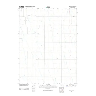
2012 Map of Norton NW
USGS Topo · Published 2012About this map
Sappa Cr meanders across the northwestern corner of this High Plains landscape in Norton County, marking a vital drainage system in an area defined by its agricultural grid. The terrain is deeply etched by a network of north-flowing tributaries, including Jones Cr, Dutch Cr, and Robinson Cr, which reveal the underlying topography of the Kansas prairie. These seasonal watercourses dictate the local road network, where routes like Road B and Road F must navigate the natural draws and rises of the land. The eastern edge of the quadrangle is characterized by a parallel series of streams—Deer Cr, Spring Cr, and Dry Cr—that underscore the importance of water management and natural drainage in this rural region. This survey captures the precisely surveyed section lines and the distribution of farmstead access points that characterize the early 21st-century rural Kansas infrastructure.
Find a feature on this map
11 named features on this map. Tap any name to fly to it.
Don’t see what you’re looking for? This feature index may not catch every label — zoom into the map to look around manually.
Map Details
Editions of this 2012 Norton NW Map
This is the sole edition of this map. No revisions or reprints were ever made.
Other maps of this area

1893 · Norton
USGS Topo · 1:125,000

1896 · Arapahoe
USGS Topo · 1:125,000

1898 · Arapahoe
USGS Topo · 1:125,000

1951 · Norton
USGS Topo · 1:62,500

1951 · Norcatur
USGS Topo · 1:62,500

1954 · McCook
USGS Topo · 1:250,000

1954 · Goodland
USGS Topo · 1:250,000

1955 · Grand Island
USGS Topo · 1:250,000

1955 · Beloit
USGS Topo · 1:250,000

1956 · Goodland
USGS Topo · 1:250,000