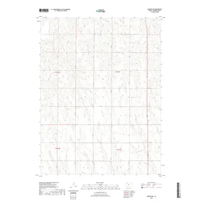
2018 Map of Norton NW
USGS Topo · Published 2018About this map
The northwest corner of Norton County reveals a landscape shaped by a complex network of intermittent drainages and section-line roads. High plains terrain is defined by the winding course of Sappa Cr in the northern reaches, while other seasonal waterways like Spring Cr and Deer Cr carve through the prairie. The map provides a clear look at the Public Land Survey System (PLSS) grid, showing the boundaries for t1s r24w, t1s r23w, t2s r24w, and t2s r23w. This intersection of topography and geometry illustrates the persistent agricultural layout of Northwest Kansas, where established routes like Road E and RD G provide access to the drainage basins of Robinson Cr and Jones Cr. Local researchers can trace the exact land partitions and drainage patterns that have dictated ranching and farming boundaries for generations.
Find a feature on this map
25 named features on this map. Tap any name to fly to it.
Don’t see what you’re looking for? This feature index may not catch every label — zoom into the map to look around manually.
Map Details
Editions of this 2018 Norton NW Map
This is the sole edition of this map. No revisions or reprints were ever made.
Other maps of this area

1893 · Norton
USGS Topo · 1:125,000

1896 · Arapahoe
USGS Topo · 1:125,000

1898 · Arapahoe
USGS Topo · 1:125,000

1951 · Norton
USGS Topo · 1:62,500

1951 · Norcatur
USGS Topo · 1:62,500

1954 · McCook
USGS Topo · 1:250,000

1954 · Goodland
USGS Topo · 1:250,000

1955 · Grand Island
USGS Topo · 1:250,000

1955 · Beloit
USGS Topo · 1:250,000

1956 · Goodland
USGS Topo · 1:250,000