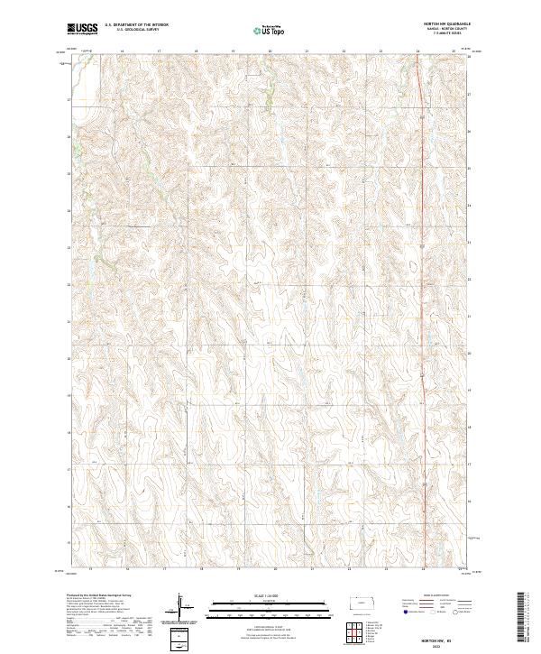
2022 Map of Norton NW
USGS Topo · Published 2022About this map
Sappa Cr meanders across the northwestern corner of this Norton County landscape, defining a terrain dominated by an intricate drainage system of seasonal creeks and draws. The map illustrates a strictly organized agricultural grid, where arterial routes like Road E and Rd I bisect the high ground between watersheds. The land is etched by numerous tributaries including Dutch Cr, Robinson Cr, and Spring Cr, which have carved deep fingers into the Kansas plains. This 2022 survey reveals a classic High Plains settlement pattern where modern county roads adhere to the section lines established by the Public Land Survey System, as seen in the boundaries of t1s r23w and t2s r24w. The scarcity of named structures emphasizes the open, rural nature of this territory, where the economy remains tied to the hydrology of features like Deer Cr and Jones Cr.
Find a feature on this map
20 named features on this map. Tap any name to fly to it.
Don’t see what you’re looking for? This feature index may not catch every label — zoom into the map to look around manually.
Map Details
Editions of this 2022 Norton NW Map
This is the sole edition of this map. No revisions or reprints were ever made.
Other maps of this area

1893 · Norton
USGS Topo · 1:125,000

1896 · Arapahoe
USGS Topo · 1:125,000

1898 · Arapahoe
USGS Topo · 1:125,000

1951 · Norton
USGS Topo · 1:62,500

1951 · Norcatur
USGS Topo · 1:62,500

1954 · McCook
USGS Topo · 1:250,000

1954 · Goodland
USGS Topo · 1:250,000

1955 · Grand Island
USGS Topo · 1:250,000

1955 · Beloit
USGS Topo · 1:250,000

1956 · Goodland
USGS Topo · 1:250,000