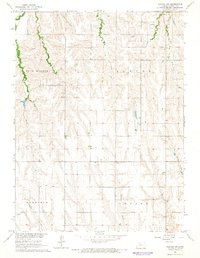
1965 Map of Norton NW
USGS Topo · Published 1966About this map
Sappa Creek and Jones Creek meander through the northwest corner of this Kansas landscape, reflecting the intricate drainage patterns of the high plains in the mid-1960s. The area is defined by its agricultural and township structure, spanning the rural districts of Garfield, Center, and Aladine. A notable landmark for local history and genealogy is Grace Chapel, which stands alone among the section lines north of the Rock Branch terrain feature. The map captures the region after decades of settlement, where numerous small tributaries like Boy Creek, Dutch Creek, and Deer Creek cut through the topography, dictating the placement of farmsteads and rural roads. This survey, part of the Missouri River Basin development program, provides a detailed view of the water resources and land divisions in Norton County before modern consolidated farming shifted the footprint of the rural community.
Find a feature on this map
14 named features on this map. Tap any name to fly to it.
Don’t see what you’re looking for? This feature index may not catch every label — zoom into the map to look around manually.
Map Details
Editions of this 1965 Norton NW Map
This is the sole edition of this map. No revisions or reprints were ever made.
Other maps of this area

1893 · Norton
USGS Topo · 1:125,000

1896 · Arapahoe
USGS Topo · 1:125,000

1898 · Arapahoe
USGS Topo · 1:125,000

1951 · Norton
USGS Topo · 1:62,500

1951 · Norcatur
USGS Topo · 1:62,500

1954 · McCook
USGS Topo · 1:250,000

1954 · Goodland
USGS Topo · 1:250,000

1955 · Grand Island
USGS Topo · 1:250,000

1955 · Beloit
USGS Topo · 1:250,000

1956 · Goodland
USGS Topo · 1:250,000