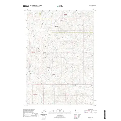
2020 Map of Nortons
USGS Topo · Published 2020About this map
The Yaquina River winds through the heart of this coastal range landscape, south of the small settlement of Nortons. This interior section of the Coast Range is defined by a series of named ridges and gaps that dictated early travel and timber access, including Steer Divide, Indian Gap, and Millers Gap. The topographical names suggest a history of early homesteading and localized education, as seen with Tater Hill, Norton Hill, and School Hill. Local genealogy is anchored by the Nortons Cem near the river and the Wigle Cem to the northwest. The drainage network is dense with tributaries like Buttermilk Cr and Little Rock Cr, while the inclusion of Buttermilk Lake provides a rare standing water feature in this elevation-heavy terrain.
Find a feature on this map
66 named features on this map. Tap any name to fly to it.
Don’t see what you’re looking for? This feature index may not catch every label — zoom into the map to look around manually.
Map Details
Editions of this 2020 Nortons Map
This is the sole edition of this map. No revisions or reprints were ever made.
Other maps of this area

1939 · Marys Peak
USGS Topo · 1:62,500

1942 · Euchre Mtn
USGS Topo · 1:62,500

1942 · Marys Peak
USGS Topo · 1:62,500

1942 · Valsetz
USGS Topo · 1:62,500

1942 · Toledo
USGS Topo · 1:62,500

1943 · Euchre Mtn
USGS Topo · 1:62,500

1953 · Salem
USGS Topo · 1:250,000

1954 · Salem
USGS Topo · 1:250,000

1956 · Valsetz
USGS Topo · 1:62,500

1957 · Marys Peak
USGS Topo · 1:62,500