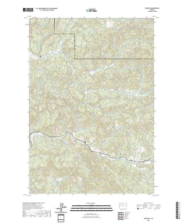
2023 Map of Nortons
USGS Topo · Published 2023About this map
Nortons serves as the central settlement point in this section of the Oregon Coast Range, where the Laguna River winds through a landscape of steep timbered ridges and narrow creek valleys. The local geography is defined by family and descriptive landmarks, such as Norton Hill and School Hill, which overlook the river's path. For genealogists and local historians, the presence of the Nortons Cem and Wigle Cem offers precise locations for tracing early families who settled along the river and its tributaries like Buttermilk Creek. This 2023 edition highlights a network of secondary roads, including Logsden Rd and Nashville Rd, that connect these isolated valley communities. Higher elevations are marked by notable passages such as Millers Gap, Indian Gap, and the Steer Divide, indicating the historic routes used to navigate the divide between Lincoln County and Polk County.
Find a feature on this map
65 named features on this map. Tap any name to fly to it.
Don’t see what you’re looking for? This feature index may not catch every label — zoom into the map to look around manually.
Map Details
Editions of this 2023 Nortons Map
This is the sole edition of this map. No revisions or reprints were ever made.
Other maps of this area

1939 · Marys Peak
USGS Topo · 1:62,500

1942 · Euchre Mtn
USGS Topo · 1:62,500

1942 · Marys Peak
USGS Topo · 1:62,500

1942 · Valsetz
USGS Topo · 1:62,500

1942 · Toledo
USGS Topo · 1:62,500

1943 · Euchre Mtn
USGS Topo · 1:62,500

1953 · Salem
USGS Topo · 1:250,000

1954 · Salem
USGS Topo · 1:250,000

1956 · Valsetz
USGS Topo · 1:62,500

1957 · Marys Peak
USGS Topo · 1:62,500