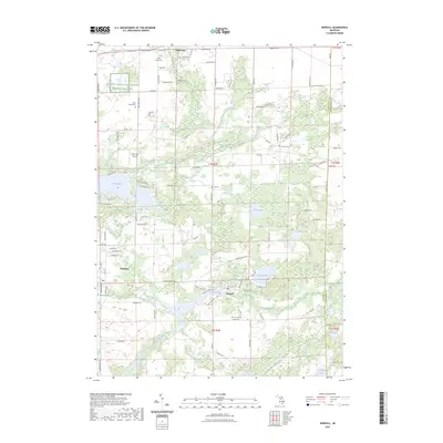
2023 Map of Norvell
USGS Topo · Published 2023About this map
Norvell and the surrounding Jackson County countryside appear as a mosaic of wetlands and small agricultural settlements in this 2023 survey. The landscape is defined by the winding course of the River Raisin and its tributary, the Norvell-Manchester Drain. These waterways connect a series of glacial lakes, including Norvell Lake, Sweezy Lake, and Mud Lake, illustrating the complex hydrology of south-central Michigan. For genealogists, the map is particularly useful for locating numerous community burial grounds such as Oak Grove Cem, Fishville Cem, and Maple Grove Cem near Grass Lake. The northern portion of the map includes the Jackson County Waterfowl Production Area, highlighting the conservation of the region's marshy terrain. Small-scale aviation history is noted at the Wolf Lake Airport west of Mellen Camp Lake, while the village of Napoleon anchors the western edge of the quadrangle.
Find a feature on this map
101 named features on this map. Tap any name to fly to it.
Don’t see what you’re looking for? This feature index may not catch every label — zoom into the map to look around manually.
Map Details
Editions of this 2023 Norvell Map
This is the sole edition of this map. No revisions or reprints were ever made.
Other maps of this area

1919 · Stockbridge
USGS Topo · 1:62,500

1919 · Rives Junction
USGS Topo · 1:62,500

1921 · Rives Junction
USGS Topo · 1:62,500

1922 · Stockbridge
USGS Topo · 1:62,500

1935 · Jackson
USGS Topo · 1:48,000

1939 · Jackson
USGS Topo · 1:62,500

1942 · Stockbridge
USGS Topo · 1:62,500

1948 · Manchester
USGS Topo · 1:62,500

1949 · Manchester
USGS Topo · 1:62,500

1958 · Grand Rapids
USGS Topo · 1:250,000