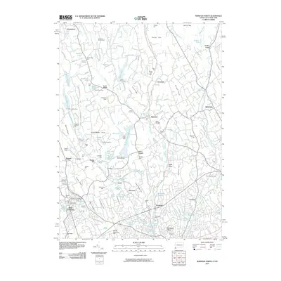
2010 Map of Norwalk North
USGS Topo · Published 2010About this map
The Norwalk River corridor defines the geography of southwestern Connecticut in this 2010 study, connecting the settlements of Wilton, South Wilton, and Winnipauk. The map reveals a suburban landscape still deeply rooted in its colonial and industrial past, where family-named ridges like Belden Hill, Sturges Ridge, and Clapboard Hill rise above a dense network of reservoirs and mill sites. Water power remains a visible legacy at Daniels Mill and the many dams along the Silvermine River, including the Grupes Reservoir Dam and Popes Pond Dam.
Find a feature on this map
174 named features on this map. Tap any name to fly to it.
Don’t see what you’re looking for? This feature index may not catch every label — zoom into the map to look around manually.
Map Details
Editions of this 2010 Norwalk North Map
This is the sole edition of this map. No revisions or reprints were ever made.
Other maps of this area

1892 · Stamford
USGS Topo · 1:62,500

1892 · Danbury
USGS Topo · 1:62,500

1892 · Norwalk
USGS Topo · 1:62,500

1892 · Carmel
USGS Topo · 1:62,500

1893 · Carmel
USGS Topo · 1:62,500

1893 · Stamford
USGS Topo · 1:62,500

1893 · Norwalk
USGS Topo · 1:62,500

1894 · Carmel
USGS Topo · 1:62,500

1899 · Stamford
USGS Topo · 1:62,500

1915 · Danbury
USGS Topo · 1:62,500