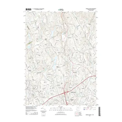
2015 Map of Norwalk North
USGS Topo · Published 2015About this map
The Silvermine River and Norwalk River corridors define the suburban landscape of Fairfield County in this 2015 study, illustrating the dense residential character of Wilton and the northern reaches of Norwalk. The map details a region where colonial-era settlement patterns meet modern infrastructure, notably along the Metro-North rail line and the busy Merritt Pkwy. Local history and genealogy interest is high, with numerous small burial grounds such as Silvermine Cem, Hillside Cem, and Bald Hill Cem scattered among the hills. The terrain is marked by distinctive rises like Sugar Loaf Hill and Grumman Hill, while the hydrography is characterized by a series of reservoirs and ponds, including S Norwalk Reservoir and Grupes Reservoir, which reflect the long-standing water management systems of these coastal Connecticut communities.
Find a feature on this map
101 named features on this map. Tap any name to fly to it.
Don’t see what you’re looking for? This feature index may not catch every label — zoom into the map to look around manually.
Map Details
Editions of this 2015 Norwalk North Map
This is the sole edition of this map. No revisions or reprints were ever made.
Other maps of this area

1892 · Stamford
USGS Topo · 1:62,500

1892 · Danbury
USGS Topo · 1:62,500

1892 · Norwalk
USGS Topo · 1:62,500

1892 · Carmel
USGS Topo · 1:62,500

1893 · Carmel
USGS Topo · 1:62,500

1893 · Stamford
USGS Topo · 1:62,500

1893 · Norwalk
USGS Topo · 1:62,500

1894 · Carmel
USGS Topo · 1:62,500

1899 · Stamford
USGS Topo · 1:62,500

1915 · Danbury
USGS Topo · 1:62,500