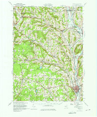
1943 Map of Norwich
USGS Topo · Published 1975About this map
Norwich serves as the focal point for this mid-century survey of Chenango County, showing the intersection of heavy rail and river valley commerce. Two major lines, the New York Ontario and Western and the Delaware Lackawanna and Western, dominate the eastern corridor along the Chenango River. This transportation network supported a series of established settlements from Earlville in the north to Polkville in the south.
Find a feature on this map
99 named features on this map. Tap any name to fly to it.
Don’t see what you’re looking for? This feature index may not catch every label — zoom into the map to look around manually.
Map Details
Editions of this 1943 Norwich Map
This is the sole edition of this map. No revisions or reprints were ever made.
Other maps of this area

1897 · Cazenovia
USGS Topo · 1:62,500

1899 · Cazenovia
USGS Topo · 1:62,500

1902 · Coventry
USGS Topo · 1:62,500

1902 · Morrisville
USGS Topo · 1:62,500

1903 · Norwich
USGS Topo · 1:62,500

1904 · Greene
USGS Topo · 1:62,500

1904 · Oxford
USGS Topo · 1:62,500

1904 · Pitcher
USGS Topo · 1:62,500

1907 · Sangerfield
USGS Topo · 1:62,500

1910 · New Berlin
USGS Topo · 1:62,500