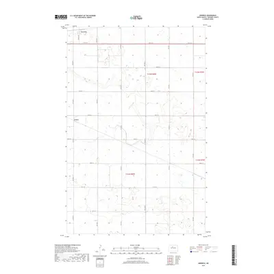
2017 Map of Norwich
USGS Topo · Published 2017About this map
Norwich and Genoa anchor this McHenry County landscape, showing the persistent agricultural grid of north-central North Dakota. The area is defined by its rectilinear road network, including north-south corridors like 19th Ave N and 14th Ave N, which intersect with long east-west stretches of 57th St N and 50th St N. This survey illustrates the township and range system in action across T155n R80w and adjacent sections, where the terrain is dotted with seasonal wetlands and small basins typical of the region. Local travel is facilitated by the prominent Norwich Rd, connecting the northern settlement to the broader county infrastructure. The map serves as a clear record of land division and rural infrastructure in the early 21st century.
Find a feature on this map
21 named features on this map. Tap any name to fly to it.
Don’t see what you’re looking for? This feature index may not catch every label — zoom into the map to look around manually.
Map Details
Editions of this 2017 Norwich Map
This is the sole edition of this map. No revisions or reprints were ever made.
Other maps of this area

1929 · Sawyer
USGS Topo · 1:62,500

1948 · Voltaire
USGS Topo · 1:24,000

1948 · Velva
USGS Topo · 1:62,500

1948 · Sawyer
USGS Topo · 1:24,000

1949 · Norwich
USGS Topo · 1:24,000

1949 · Sawyer
USGS Topo · 1:24,000

1949 · Simcoe
USGS Topo · 1:24,000

1949 · Sawyer NE
USGS Topo · 1:24,000

1949 · Velva
USGS Topo · 1:24,000

1949 · Deering SE
USGS Topo · 1:24,000