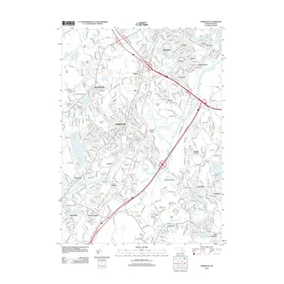
2012 Map of Norwood
USGS Topo · Published 2012About this map
The Neponset River corridor serves as the industrial and residential spine for this area southwest of Boston, where the historical footprint of mill-town growth remains visible alongside modern infrastructure. In Norwood, the central town plan is defined by a dense street grid that transitions into the Norwood Memorial Airport and the marshes of Purgatory Brook. The legacy of 19th-century transit and industry is anchored by the massive Canton Viaduct and a network of rail-connected settlements including Islington, Ellis, and Canton Junction. Between the larger centers of Dedham and Walpole, the landscape is dotted with numerous water bodies like Willett Pond and Buckmaster Pond, which historically powered the local mills. Significant historical sites, from the Old Parish Cem to the Pegutside Farm, provide specific points of interest for those tracing the evolution of these Norfolk County communities.
Find a feature on this map
93 named features on this map. Tap any name to fly to it.
Don’t see what you’re looking for? This feature index may not catch every label — zoom into the map to look around manually.
Map Details
Editions of this 2012 Norwood Map
This is the sole edition of this map. No revisions or reprints were ever made.
Other maps of this area

1886 · Dedham
USGS Topo · 1:62,500

1886 · Framingham
USGS Topo · 1:62,500

1887 · Franklin
USGS Topo · 1:62,500

1889 · Franklin
USGS Topo · 1:62,500

1889 · Framingham
USGS Topo · 1:62,500

1893 · Franklin
USGS Topo · 1:62,500

1893 · Boston
USGS Topo · 1:62,500

1894 · Dedham
USGS Topo · 1:62,500

1894 · Framingham
USGS Topo · 1:62,500

1903 · Boston
USGS Topo · 1:62,500