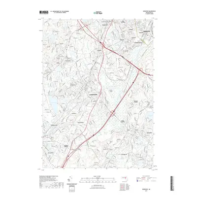
2021 Map of Norwood
USGS Topo · Published 2021About this map
Norwood and Dedham anchor this landscape south of Boston, where the winding course of the Neponset River dictates the layout of long-established settlements and transport corridors. The map highlights a complex infrastructure of modern aviation at Norwood Memorial Airport alongside significant engineering relics like the Canton Viaduct. Local history is deeply embedded in the numerous burial grounds, such as Old Parish Cem and Old Village Cem, reflecting the early roots of communities like Westwood and East Walpole. Industrial and institutional landmarks are prominent, including the Norfolk County Superior Court House and FINE Mortuary College LLC. From the residential pockets of Readville Manor and Islington to the wooded elevations of Satans Kingdom and Fox Hill, the survey details the dense suburban development and protected open spaces of Norfolk County.
Find a feature on this map
100 named features on this map. Tap any name to fly to it.
Don’t see what you’re looking for? This feature index may not catch every label — zoom into the map to look around manually.
Map Details
Editions of this 2021 Norwood Map
This is the sole edition of this map. No revisions or reprints were ever made.
Other maps of this area

1886 · Dedham
USGS Topo · 1:62,500

1886 · Framingham
USGS Topo · 1:62,500

1887 · Franklin
USGS Topo · 1:62,500

1889 · Franklin
USGS Topo · 1:62,500

1889 · Framingham
USGS Topo · 1:62,500

1893 · Franklin
USGS Topo · 1:62,500

1893 · Boston
USGS Topo · 1:62,500

1894 · Dedham
USGS Topo · 1:62,500

1894 · Framingham
USGS Topo · 1:62,500

1903 · Boston
USGS Topo · 1:62,500