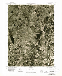
1977 Map of Norwood
USGS Topo · Published 1980About this map
The Neponset River winds through the heart of this Norfolk County landscape, serving as a geographic anchor for the burgeoning suburban developments of the late 1970s. This orthophotoquad, produced by the Commonwealth of Massachusetts Department of Public Works and the USGS, captures the dense residential and industrial patterns of Norwood and Dedham during a period of significant regional growth. The imagery provides a clear look at the intricate transportation networks and infrastructure connecting Westwood and Canton, while the southern reaches of Walpole and Sharon show more open spaces and woodland. Because it is an aerial-based orthophoto, it reveals the literal footprint of the era, from the runways of the local airport to the expanding highway interchanges that link these historic towns to the greater Boston area.
Find a feature on this map
8 named features on this map. Tap any name to fly to it.
Don’t see what you’re looking for? This feature index may not catch every label — zoom into the map to look around manually.
Map Details
Editions of this 1977 Norwood Map
This is the sole edition of this map. No revisions or reprints were ever made.
Other maps of this area

1886 · Dedham
USGS Topo · 1:62,500

1886 · Framingham
USGS Topo · 1:62,500

1887 · Franklin
USGS Topo · 1:62,500

1889 · Franklin
USGS Topo · 1:62,500

1889 · Framingham
USGS Topo · 1:62,500

1893 · Franklin
USGS Topo · 1:62,500

1893 · Boston
USGS Topo · 1:62,500

1894 · Dedham
USGS Topo · 1:62,500

1894 · Framingham
USGS Topo · 1:62,500

1903 · Boston
USGS Topo · 1:62,500