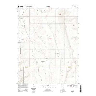
2014 Map of Notom
USGS Topo · Published 2014About this map
Notom sits at the edge of the desert landscape in this detailed topographic study of the central Utah borderlands between Wayne and Garfield counties. The settlement is defined by its proximity to the Capitol Reef National Park boundary, where the geological uplift of the Water Pocket Fold creates a dramatic western backdrop. The eastern half of the area is dominated by high plateaus including Thompson Mesa and Wildcat Mesa, separated by a network of drainage systems like Sandy Cr and Burro Wash. The mapping of local infrastructure such as Old Notom Rd and the Pleasant Creek Diversion Rd reveals how water management and transit routes were etched into the terrain. Distinctive landmarks like Bloody Hands Gap and Blue Notch highlight the unique nomenclature of this high-desert environment during the early 21st century.
Find a feature on this map
69 named features on this map. Tap any name to fly to it.
Don’t see what you’re looking for? This feature index may not catch every label — zoom into the map to look around manually.
Map Details
Editions of this 2014 Notom Map
This is the sole edition of this map. No revisions or reprints were ever made.
Other maps of this area

1885 · San Rafael
USGS Topo · 1:250,000

1885 · Fish Lake
USGS Topo · 1:250,000

1896 · Fish Lake
USGS Topo · 1:250,000

1952 · Notom 4 SE
USGS Topo · 1:24,000

1952 · Notom 4 NW
USGS Topo · 1:24,000

1952 · Notom 4 SW
USGS Topo · 1:24,000

1952 · Notom 4 NE
USGS Topo · 1:24,000

1952 · Notom 1 SW
USGS Topo · 1:24,000

1952 · Notom
USGS Topo · 1:62,500

1954 · Mt. Ellen 2 SW
USGS Topo · 1:24,000