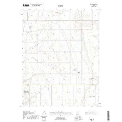
2020 Map of Notom
USGS Topo · Published 2020About this map
Notom sits at the heart of this high-desert landscape where the borders of Wayne and Garfield counties meet. The settlement is defined by a network of local roads including Notom Rd and the Notom Bullfrog Basin Rd, which navigate the complex drainage systems of Sandy Cr and Pleasant Cr. The area is characterized by dramatic elevation shifts, moving from the level expanse of Blue Flats and Tergeson Flats up to the high reaches of Thompson Mesa and Wildcat Mesa. A portion of Capitol Reef National Park occupies the southwest, where Fivemile Wash carves through the terrain. For those interested in local genealogy or pioneer history, the Esther Fenn Gravesite is a specific landmark noted near the center of the community, while the colorful naming of Bloody Hands Gap suggests the storied character of the local geography.
Find a feature on this map
23 named features on this map. Tap any name to fly to it.
Don’t see what you’re looking for? This feature index may not catch every label — zoom into the map to look around manually.
Map Details
Editions of this 2020 Notom Map
This is the sole edition of this map. No revisions or reprints were ever made.
Other maps of this area

1885 · San Rafael
USGS Topo · 1:250,000

1885 · Fish Lake
USGS Topo · 1:250,000

1896 · Fish Lake
USGS Topo · 1:250,000

1952 · Notom 4 SE
USGS Topo · 1:24,000

1952 · Notom 4 NW
USGS Topo · 1:24,000

1952 · Notom 4 SW
USGS Topo · 1:24,000

1952 · Notom 4 NE
USGS Topo · 1:24,000

1952 · Notom 1 SW
USGS Topo · 1:24,000

1952 · Notom
USGS Topo · 1:62,500

1954 · Mt. Ellen 2 SW
USGS Topo · 1:24,000