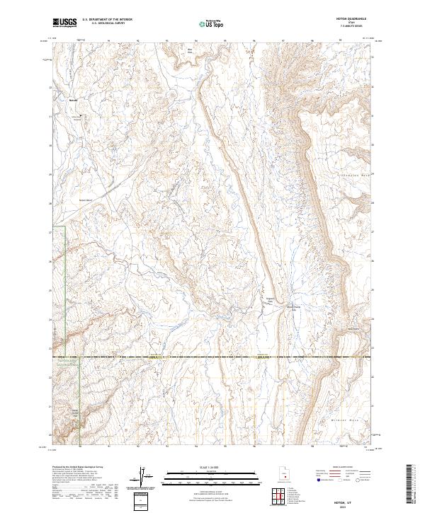
2023 Map of Notom
USGS Topo · Published 2023About this map
Notom and the high desert plains of Wayne County define this landscape along the eastern edge of Capitol Reef National Park. The map documents a rugged geology where the Water Pocket Fold creates a dramatic barrier, flanked by massive plateaus including Thompson Mesa and Wildcat Mesa. A poignant local history detail is found at the Esther Fenn Gravesite, situated near the rural roads that serve the small community of Notom.
Find a feature on this map
33 named features on this map. Tap any name to fly to it.
Don’t see what you’re looking for? This feature index may not catch every label — zoom into the map to look around manually.
Map Details
Editions of this 2023 Notom Map
This is the sole edition of this map. No revisions or reprints were ever made.
Other maps of this area

1885 · San Rafael
USGS Topo · 1:250,000

1885 · Fish Lake
USGS Topo · 1:250,000

1896 · Fish Lake
USGS Topo · 1:250,000

1952 · Notom 4 SE
USGS Topo · 1:24,000

1952 · Notom 4 NW
USGS Topo · 1:24,000

1952 · Notom 4 SW
USGS Topo · 1:24,000

1952 · Notom 4 NE
USGS Topo · 1:24,000

1952 · Notom 1 SW
USGS Topo · 1:24,000

1952 · Notom
USGS Topo · 1:62,500

1954 · Mt. Ellen 2 SW
USGS Topo · 1:24,000