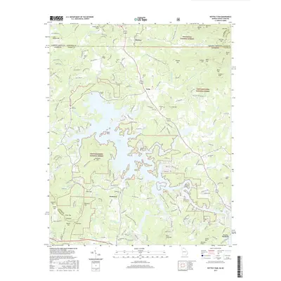
2017 Map of Nottely Dam
USGS Topo · Published 2017About this map
Nottely Lake dominates the central landscape of this Union County region, its convoluted shoreline created by the impoundment of the Nottely River at the Nottely Dam. The surrounding terrain transitions between the Nantahala National Forest to the north and the Chattahoochee National Forest to the south, marked by numerous ridges and gaps including Moccasin Gap and Wolfpen Gap. Smaller settlements like Ivylog and Bethlehem are scattered throughout the valleys, often anchored by local landmarks such as Bethlehem Cem and Casteel Cem. The map detail traces the intricate network of mountain creeks like Moccasin Cr and Chastain Br that feed into the reservoir, illustrating the area's transition from river-bottom agriculture to a landscape defined by managed forests and water resources.
Find a feature on this map
197 named features on this map. Tap any name to fly to it.
Don’t see what you’re looking for? This feature index may not catch every label — zoom into the map to look around manually.
Map Details
Editions of this 2017 Nottely Dam Map
This is the sole edition of this map. No revisions or reprints were ever made.
Other maps of this area

1886 · Dahlonega
USGS Topo · 1:125,000

1888 · Ellijay
USGS Topo · 1:125,000

1892 · Dahlonega
USGS Topo · 1:125,000

1892 · Ellijay
USGS Topo · 1:125,000

1893 · Murphy
USGS Topo · 1:125,000

1896 · Dahlonega
USGS Topo · 1:125,000

1898 · Ellijay
USGS Topo · 1:125,000

1903 · Dahlonega
USGS Topo · 1:125,000

1911 · Ellijay
USGS Topo · 1:125,000

1914 · Murphy
USGS Topo · 1:125,000