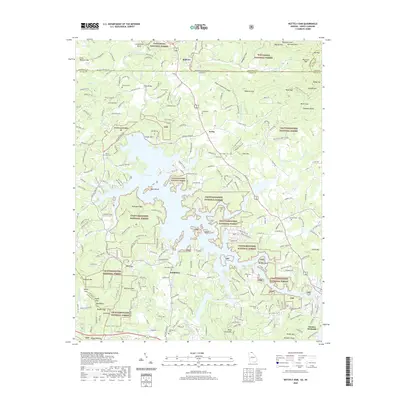
2020 Map of Nottely Dam
USGS Topo · Published 2020About this map
Nottely Lake dominates this landscape, its fingers reaching into the valleys of the Nottely River and Ivylog Creek. The map documents the complex topography of the Blue Ridge foothills, where the Nantahala National Forest meets the Chattahoochee National Forest at the Georgia-North Carolina border. The northern reaches show agricultural life near Bellview, while the southern half is punctuated by numerous family and community cemeteries such as Bethany Cem, Confidence Cem, and Ivy Log Cem, reflecting the deep ancestral roots of Union County. Near the southern edge, the Notalee Orchards signal the local mountain economy. The infrastructure of the Nottely Dam itself is a central landmark, managing the waters that flow from the southern peaks like Blackjack Mtn and Peter Young Mtn toward the Loudermild Bend.
Find a feature on this map
239 named features on this map. Tap any name to fly to it.
Don’t see what you’re looking for? This feature index may not catch every label — zoom into the map to look around manually.
Map Details
Editions of this 2020 Nottely Dam Map
This is the sole edition of this map. No revisions or reprints were ever made.
Other maps of this area

1886 · Dahlonega
USGS Topo · 1:125,000

1888 · Ellijay
USGS Topo · 1:125,000

1892 · Dahlonega
USGS Topo · 1:125,000

1892 · Ellijay
USGS Topo · 1:125,000

1893 · Murphy
USGS Topo · 1:125,000

1896 · Dahlonega
USGS Topo · 1:125,000

1898 · Ellijay
USGS Topo · 1:125,000

1903 · Dahlonega
USGS Topo · 1:125,000

1911 · Ellijay
USGS Topo · 1:125,000

1914 · Murphy
USGS Topo · 1:125,000