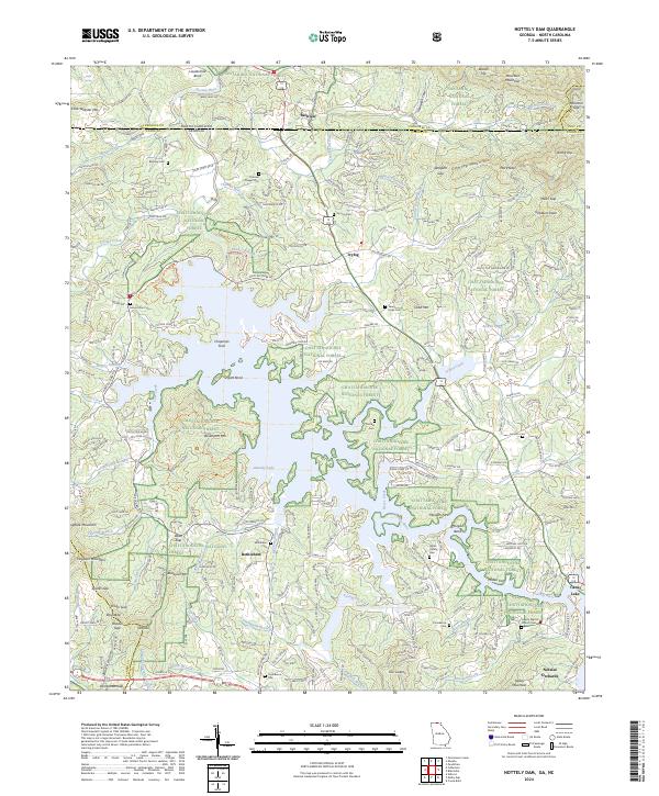
2024 Map of Nottely Dam
USGS Topo · Published 2024About this map
The Nottely River winds across the North Carolina and Georgia state line, feeding into the expansive waters of Nottely Lake. This modern record of the North Georgia highlands highlights the dense network of forest roads and hiking trails, including the Hawksclaw Trl and Tomahawk Trl, that permeate the Chattahoochee National Forest and Nantahala National Forest. Smaller settlements like Ivylog and Bethlehem serve as focal points for local history, centered around longstanding community landmarks such as Bethlehem Cem and Thomas Chapel Cem. The landscape is defined by its high-altitude peaks and gaps, from Moccasin Mountain in the northeast to Hogback Mountain in the southwest. Cultural sites like the Liberty Baptist Church Cem and Notalee Orchards illustrate the persistent connection between the resident population and this mountainous terrain along the Union County boundary.
Find a feature on this map
249 named features on this map. Tap any name to fly to it.
Don’t see what you’re looking for? This feature index may not catch every label — zoom into the map to look around manually.
Map Details
Editions of this 2024 Nottely Dam Map
This is the sole edition of this map. No revisions or reprints were ever made.
Other maps of this area

1886 · Dahlonega
USGS Topo · 1:125,000

1888 · Ellijay
USGS Topo · 1:125,000

1892 · Dahlonega
USGS Topo · 1:125,000

1892 · Ellijay
USGS Topo · 1:125,000

1893 · Murphy
USGS Topo · 1:125,000

1896 · Dahlonega
USGS Topo · 1:125,000

1898 · Ellijay
USGS Topo · 1:125,000

1903 · Dahlonega
USGS Topo · 1:125,000

1911 · Ellijay
USGS Topo · 1:125,000

1914 · Murphy
USGS Topo · 1:125,000