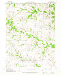
1965 Map of Novelty
USGS Topo · Published 1966About this map
The settlement of Novelty anchors this mid-century view of Knox County, Missouri, where the landscape is defined by the dendritic drainage patterns of the Little Fabius River and its many tributaries. This survey, compiled from 1963 aerial photography and field-checked by the USGS in 1965, documents a predominantly agricultural region interspersed with rural social centers like Mt Carmel Ch and Harmony Ch. To the east, the small community of Hedge City sits near the winding course of Hickory Creek, reflecting the localized settlement patterns that persisted in the state's northeastern corner.
Find a feature on this map
20 named features on this map. Tap any name to fly to it.
Don’t see what you’re looking for? This feature index may not catch every label — zoom into the map to look around manually.
Map Details
Editions of this 1965 Novelty Map
This is the sole edition of this map. No revisions or reprints were ever made.
Other maps of this area

1903 · Edina
USGS Topo · 1:125,000

1908 · Atlanta
USGS Topo · 1:62,500

1953 · Moberly
USGS Topo · 1:250,000

1954 · Centerville
USGS Topo · 1:250,000

1954 · Moberly
USGS Topo · 1:250,000

1957 · Moberly
USGS Topo · 1:250,000

1957 · Centerville
USGS Topo · 1:250,000

1958 · Centerville
USGS Topo · 1:250,000

1960 · Moberly
USGS Topo · 1:250,000
1963 · Leonard
USGS Topo · 1:24,000