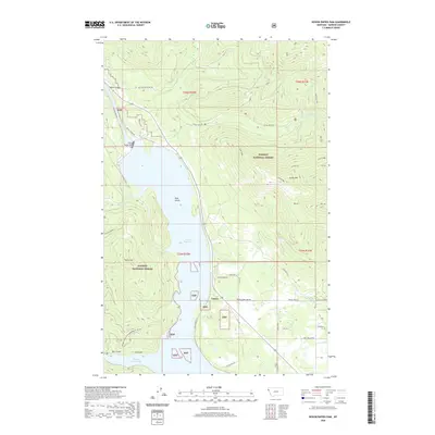
2020 Map of Noxon Rapids Dam
USGS Topo · Published 2020About this map
The Noxon Rapids Dam anchors the Clark Fork waterway in Sanders County, creating the expansive Noxon Reservoir that dominates the central valley. This 2020 survey illustrates the complex geography of the Kaniksu National Forest, where the small settlement of Tuscor sits at the base of Tuscor Hill near the reservoir's edge. The terrain transitions sharply from the water's edge to the high peaks of Green Mtn and the long spine of Goat Ridge to the east.
Find a feature on this map
41 named features on this map. Tap any name to fly to it.
Don’t see what you’re looking for? This feature index may not catch every label — zoom into the map to look around manually.
Map Details
Editions of this 2020 Noxon Rapids Dam Map
This is the sole edition of this map. No revisions or reprints were ever made.
Other maps of this area

1920 · Libby
USGS Topo · 1:125,000

1930 · Libby
USGS Topo · 1:125,000

1932 · Libby
USGS Topo · 1:125,000

1932 · Trout Creek
USGS Topo · 1:125,000

1935 · Trout Creek
USGS Topo · 1:125,000

1936 · Trout Creek
USGS Topo · 1:125,000

1956 · Wallace
USGS Topo · 1:250,000

1957 · Kalispell
USGS Topo · 1:250,000

1960 · Kalispell
USGS Topo · 1:250,000

1960 · Wallace
USGS Topo · 1:250,000