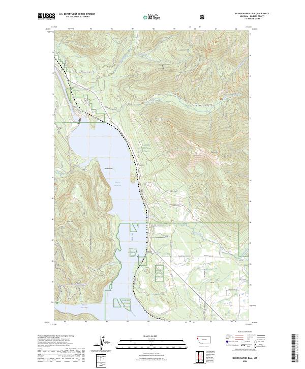
2024 Map of Noxon Rapids Dam
USGS Topo · Published 2024About this map
The Clark Fork river valley dominates this Sanders County landscape, where the waters of the Noxon Reservoir have transformed the terrain between the Cabinet Mountains and the Coeur d'Alene Mountains. Small settlements and housing areas like Tuscor and WWP Village sit along the shoreline, connected by a network of utility and forest roads such as Avista Power Rd and McKay Creek Rd. The reservoir's influence is evident in the formation of Rock Island and the broad Marten Creek Bay to the south.
Find a feature on this map
53 named features on this map. Tap any name to fly to it.
Don’t see what you’re looking for? This feature index may not catch every label — zoom into the map to look around manually.
Map Details
Editions of this 2024 Noxon Rapids Dam Map
This is the sole edition of this map. No revisions or reprints were ever made.
Other maps of this area

1920 · Libby
USGS Topo · 1:125,000

1930 · Libby
USGS Topo · 1:125,000

1932 · Libby
USGS Topo · 1:125,000

1932 · Trout Creek
USGS Topo · 1:125,000

1935 · Trout Creek
USGS Topo · 1:125,000

1936 · Trout Creek
USGS Topo · 1:125,000

1956 · Wallace
USGS Topo · 1:250,000

1957 · Kalispell
USGS Topo · 1:250,000

1960 · Kalispell
USGS Topo · 1:250,000

1960 · Wallace
USGS Topo · 1:250,000