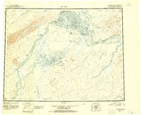
1951 Map of Nulato
USGS Topo · Published 1951About this map
The confluence of the Koyukuk River and the Yukon River defines this subarctic interior landscape during the mid-century, where river navigation remained the primary link between isolated settlements. Native villages and trading sites like Koyukuk and Kaltag are positioned at strategic river bends, while the Kaltag Portage serves as a critical overland route connecting the Yukon valley to the Norton Sound region. The map meticulously records the complex drainage system of the Kaiyuh Mountains, including the meandering Khotol River and Kaiyuh Slough.
Find a feature on this map
36 named features on this map. Tap any name to fly to it.
Don’t see what you’re looking for? This feature index may not catch every label — zoom into the map to look around manually.
Map Details
Editions of this 1951 Nulato Map
2 editions found
Other maps of this area

1945 · Nulato
USGS Topo · 1:250,000

1948 · Norton Bay
USGS Topo · 1:250,000

1950 · Medfra
USGS Topo · 1:250,000

1951 · Candle
USGS Topo · 1:250,000

1951 · Ophir
USGS Topo · 1:250,000

1951 · Nulato
USGS Topo · 1:250,000

1951 · Unalakleet
USGS Topo · 1:250,000

1951 · Ruby
USGS Topo · 1:250,000

1951 · Norton Bay
USGS Topo · 1:250,000

1951 · Kateel River
USGS Topo · 1:250,000