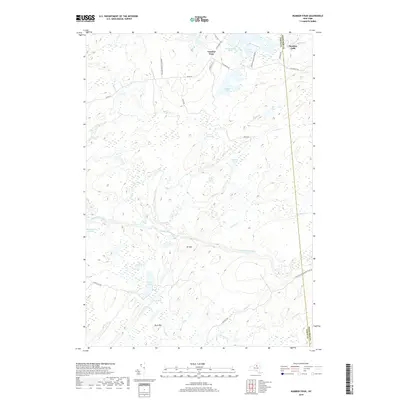
2019 Map of Number Four
USGS Topo · Published 2019About this map
Number Four serves as a lone historic outpost within the expansive Adirondack Park Preserve on this 21st-century survey. The landscape is defined by its complex hydrology, where the Independence River and Sunday Cr course through the terrain toward Moshier Falls. This region, split by the Lewis and Herkimer county line, is densely populated by named water bodies rather than settlements. Notable landmarks such as Francis Lake, Beaver Lake, and Stony Lake dominate the northern and southern sections. Rising above the wetlands and interconnected ponds are the prominent heights of Mt Tom and Buck Mtn, while the winding Crooked Creek and Yellow Cr illustrate the intricate drainage patterns typical of this portion of the Tug Hill transition. The presence of primitive routes like Adk Trl and Ten Mile Rd suggests a landscape dedicated to seasonal recreation and wilderness preservation.
Find a feature on this map
39 named features on this map. Tap any name to fly to it.
Don’t see what you’re looking for? This feature index may not catch every label — zoom into the map to look around manually.
Map Details
Editions of this 2019 Number Four Map
This is the sole edition of this map. No revisions or reprints were ever made.
Other maps of this area

1905 · Port Leyden
USGS Topo · 1:62,500

1907 · Port Leyden
USGS Topo · 1:62,500

1911 · Lowville
USGS Topo · 1:62,500

1912 · Number Four
USGS Topo · 1:62,500

1912 · Mc Keever
USGS Topo · 1:62,500

1913 · Lowville
USGS Topo · 1:62,500

1915 · Number Four
USGS Topo · 1:62,500

1940 · Port Leyden
USGS Topo · 1:62,500

1950 · Utica
USGS Topo · 1:250,000

1957 · Utica
USGS Topo · 1:250,000