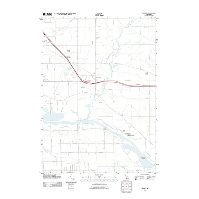
2011 Map of Nunica
USGS Topo · Published 2011About this map
The Grand River carves a wide path through this portion of Ottawa and Muskegon Counties, defining a landscape of bayous and low-lying riverine features. The settlement of Nunica sits as a central hub, where the Nunica Post Office and Nunica Cemetery mark the community's enduring presence north of the river. To the southeast, the historic site of Ottawa Center remains visible near the Ottawa Center Cemetery and the winding course of Crockery Creek, reflecting the area's early river-dependent development.
Find a feature on this map
77 named features on this map. Tap any name to fly to it.
Don’t see what you’re looking for? This feature index may not catch every label — zoom into the map to look around manually.
Map Details
Editions of this 2011 Nunica Map
This is the sole edition of this map. No revisions or reprints were ever made.
Other maps of this area

1929 · Holland
USGS Topo · 1:62,500

1930 · Muskegon
USGS Topo · 1:62,500

1932 · Holland
USGS Topo · 1:62,500

1936 · Muskegon
USGS Topo · 1:62,500

1945 · Ravenna
USGS Topo · 1:62,500

1954 · Milwaukee
USGS Topo · 1:250,000

1954 · Midland
USGS Topo · 1:250,000

1958 · Midland
USGS Topo · 1:250,000

1958 · Milwaukee
USGS Topo · 1:250,000

1958 · Allendale
USGS Topo · 1:24,000
Featured Places
- Fruitport Charter Township, MI
- Ravenna Township, MI
- Nunica, MI
- Sullivan Township, MI
- Crockery Township, MI