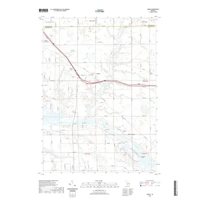
2019 Map of Nunica
USGS Topo · Published 2019About this map
The Grand River dominates the southern landscape of this Ottawa County region, carving a wide path through a series of significant bayous and inlets. This 2019 survey documents the intricate wetlands and water bodies that define the area, including Robinson Bayou, Bruce Bayou, and Connor Bayou. The settlement of Nunica serves as a central hub, situated where local roads like Michigan Ave and Cleveland St converge near the modern interstate corridor.
Find a feature on this map
66 named features on this map. Tap any name to fly to it.
Don’t see what you’re looking for? This feature index may not catch every label — zoom into the map to look around manually.
Map Details
Editions of this 2019 Nunica Map
This is the sole edition of this map. No revisions or reprints were ever made.
Other maps of this area

1929 · Holland
USGS Topo · 1:62,500

1930 · Muskegon
USGS Topo · 1:62,500

1932 · Holland
USGS Topo · 1:62,500

1936 · Muskegon
USGS Topo · 1:62,500

1945 · Ravenna
USGS Topo · 1:62,500

1954 · Milwaukee
USGS Topo · 1:250,000

1954 · Midland
USGS Topo · 1:250,000

1958 · Midland
USGS Topo · 1:250,000

1958 · Milwaukee
USGS Topo · 1:250,000

1958 · Allendale
USGS Topo · 1:24,000
Featured Places
- Fruitport Charter Township, MI
- Ravenna Township, MI
- Nunica, MI
- Sullivan Township, MI
- Crockery Township, MI