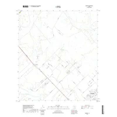
2019 Map of Nursery
USGS Topo · Published 2019About this map
The Guadalupe River winds through the southern reaches of this landscape, marking the transition into the outskirts of Victoria. Much of the map's character is defined by the rural community of Nursery, where agricultural land and ranching roads like Adcock Ranch Rd and Villafranca Ranch Rd dominate the terrain north of the city. Several small watercourses, including Spring Cr and Willow Cr, drain the interior, creating a network of riparian corridors through the open Texas prairie.
Find a feature on this map
74 named features on this map. Tap any name to fly to it.
Don’t see what you’re looking for? This feature index may not catch every label — zoom into the map to look around manually.
Map Details
Editions of this 2019 Nursery Map
This is the sole edition of this map. No revisions or reprints were ever made.
Other maps of this area

1951 · Inez NW
USGS Topo · 1:24,000

1952 · Victoria East
USGS Topo · 1:24,000

1953 · Beeville
USGS Topo · 1:250,000

1953 · Seguin
USGS Topo · 1:250,000

1956 · Beeville
USGS Topo · 1:250,000

1958 · Seguin
USGS Topo · 1:250,000

1960 · Beeville
USGS Topo · 1:250,000

1962 · Verhelle
USGS Topo · 1:24,000

1963 · Fordtran
USGS Topo · 1:24,000

1963 · Nursery
USGS Topo · 1:24,000