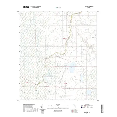
2021 Map of Nutall Rise
USGS Topo · Published 2021About this map
The Aucilla River and Wacissa River define this wet, low-lying landscape along the border of Jefferson and Taylor counties. This environment is characterized by significant hydrological features including the Slave Canal and several notable hammocks such as Bushy Hammock and Powell Hammock. Small settlements like Nutall Rise, Cabbage Grove, and Scanlon provide points of human occupancy amidst the swampy terrain. The map details an intricate network of recreation and history, shown through the Florida National Scenic Trail and the Aucilla Wildlife Management Area Trail. The convergence of these waterways, including Sulfur Creek and Page Creek, highlights the complex drainage patterns of the Big Bend region, where the limestone-heavy geology creates the distinct sinks and rises for which the area is known.
Find a feature on this map
40 named features on this map. Tap any name to fly to it.
Don’t see what you’re looking for? This feature index may not catch every label — zoom into the map to look around manually.
Map Details
Editions of this 2021 Nutall Rise Map
This is the sole edition of this map. No revisions or reprints were ever made.
Other maps of this area

1954 · Johnson Hammock
USGS Topo · 1:24,000

1954 · Cody
USGS Topo · 1:24,000

1954 · St. Marks NE
USGS Topo · 1:24,000

1954 · Cobb Rocks
USGS Topo · 1:24,000

1954 · Valdosta
USGS Topo · 1:250,000

1954 · Tallahassee
USGS Topo · 1:250,000

1955 · Snipe Island
USGS Topo · 1:24,000

1955 · Nutall Rise
USGS Topo · 1:24,000

1955 · Lamont SE
USGS Topo · 1:24,000

1955 · Manlin Hammock
USGS Topo · 1:24,000