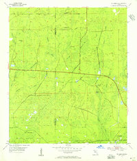
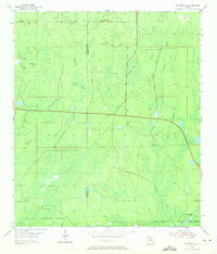
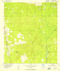
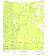
1954 Map of St. Marks NE
USGS Topo · Published 1956About this map
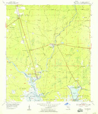
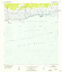
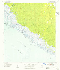
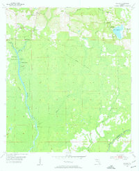
St Marks National Wildlife Refuge dominates the southern reaches of this landscape along the border of Wakulla and Jefferson Counties. This 1950s survey documents a complex karst environment where water frequently disappears underground, evidenced by numerous named geologic features such as Bear Bay Sink, Indian Camp Sink, and the cluster at Pinhook Sinks. The terrain is characterized by a low-lying network of drainage ways including Henderson Slough and Morrison Branch, which feed into the dense Gum Swamp. Grounded in planetable surveys, the map reveals a largely undeveloped region defined by private timber or agricultural tracks and distinctive natural landmarks like the Sand Hills and Smoky Hammock. The drainage pattern of the Pinhook River and East River illustrates the hydrology of the Florida Panhandle before significant modern coastal development, preserving the locations of remote spots like Jake Hole and Gator Creek.
Find a feature on this map
21 named features on this map. Tap any name to fly to it.
Don’t see what you’re looking for? This feature index may not catch every label — zoom into the map to look around manually.
Map Details
Editions of this 1954 St. Marks NE Map
2 editions found
Other maps of this area
1954 · Sprague Island
USGS Topo · 1:24,000
1954 · Cody
USGS Topo · 1:24,000
1954 · Woodville
USGS Topo · 1:24,000
1954 · St. Marks
USGS Topo · 1:24,000
1954 · Cobb Rocks
USGS Topo · 1:24,000

1954 · Valdosta
USGS Topo · 1:250,000

1954 · Tallahassee
USGS Topo · 1:250,000
1955 · Snipe Island
USGS Topo · 1:24,000
1955 · Nutall Rise
USGS Topo · 1:24,000
1955 · Wacissa
USGS Topo · 1:24,000