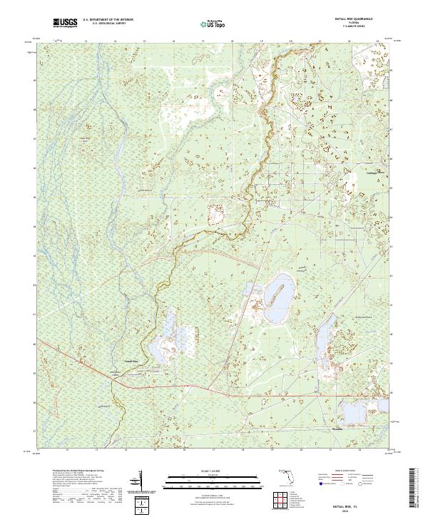
2024 Map of Nutall Rise
USGS Topo · Published 2024About this map
The Aucilla River and Wacissa River define this wet, karst-heavy landscape where Jefferson and Taylor counties meet. The convergence at Nutall Rise serves as a focal point for the region's complex hydrology, characterized by a network of river trails and the historic Slave Canal. This area is a patchwork of conservation land and swampy hammocks, with significant portions protected within the Saint Marks National Wildlife Refuge.
Find a feature on this map
42 named features on this map. Tap any name to fly to it.
Don’t see what you’re looking for? This feature index may not catch every label — zoom into the map to look around manually.
Map Details
Editions of this 2024 Nutall Rise Map
This is the sole edition of this map. No revisions or reprints were ever made.
Other maps of this area

1954 · Johnson Hammock
USGS Topo · 1:24,000

1954 · Cody
USGS Topo · 1:24,000

1954 · St. Marks NE
USGS Topo · 1:24,000

1954 · Cobb Rocks
USGS Topo · 1:24,000

1954 · Valdosta
USGS Topo · 1:250,000

1954 · Tallahassee
USGS Topo · 1:250,000

1955 · Snipe Island
USGS Topo · 1:24,000

1955 · Nutall Rise
USGS Topo · 1:24,000

1955 · Lamont SE
USGS Topo · 1:24,000

1955 · Manlin Hammock
USGS Topo · 1:24,000