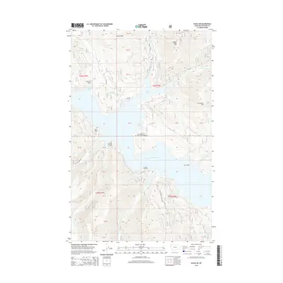
2014 Map of Nyack SW
USGS Topo · Published 2014About this map
Hungry Horse Reservoir dominates this portion of the Flathead National Forest, where the impounded waters of Hungry Horse Lake fill the deep valleys between high peaks. The 2014 landscape is defined by its complex shoreline, featuring prominent landmarks like Doris Point and Lost Johnny Point, while Fire Island remains one of the few emergent landmasses within the reservoir's southern reaches. High-elevation points such as Firefighter Mtn and Hungry Horse Mtn overlook a network of specialized infrastructure, including the Highline Loop Rd and W Side Rd, which facilitate access through this managed timber and recreational area. The presence of Wounded Buck Vista and Lion Hill Gorge highlights the dramatic vertical relief that characterizes this section of Flathead County.
Find a feature on this map
35 named features on this map. Tap any name to fly to it.
Don’t see what you’re looking for? This feature index may not catch every label — zoom into the map to look around manually.
Map Details
Editions of this 2014 Nyack SW Map
This is the sole edition of this map. No revisions or reprints were ever made.
Other maps of this area

1914 · Nyack
USGS Topo · 1:125,000

1943 · Kalispell
USGS Topo · 1:125,000

1957 · Kalispell
USGS Topo · 1:250,000

1960 · Kalispell
USGS Topo · 1:250,000

1960 · Cut Bank
USGS Topo · 1:250,000

1961 · Kalispell
USGS Topo · 1:250,000

1962 · Doris Mountain
USGS Topo · 1:24,000

1962 · Hungry Horse
USGS Topo · 1:24,000

1962 · Hash Mountain
USGS Topo · 1:24,000

1963 · Cut Bank
USGS Topo · 1:250,000