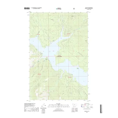
2020 Map of Nyack SW
USGS Topo · Published 2020About this map
Hungry Horse Reservoir dominates this portion of the Flathead National Forest, where the impounded waters of Hungry Horse Lake fill the deep valleys of the northern Rockies. The landscape is defined by massive ridges and peaks, including Hungry Horse Mtn and Firefighter Mtn, separated by a dense network of drainages like Wounded Buck Cr and Lost Johnny Cr. The geography reflects a managed wilderness, where access is provided by numerous Forest Service routes such as the Highline Loop Rd and Doris Creek Rd. Notable landmarks along the shoreline include Doris Point, Lost Johnny Point, and the isolated Fire Island. This area showcases the 21st-century state of Montana's timber and water management regions, with technical features like Lion Hill Gorge and Jimmie Ridge providing specific points of interest for topographical study.
Find a feature on this map
45 named features on this map. Tap any name to fly to it.
Don’t see what you’re looking for? This feature index may not catch every label — zoom into the map to look around manually.
Map Details
Editions of this 2020 Nyack SW Map
This is the sole edition of this map. No revisions or reprints were ever made.
Other maps of this area

1914 · Nyack
USGS Topo · 1:125,000

1943 · Kalispell
USGS Topo · 1:125,000

1957 · Kalispell
USGS Topo · 1:250,000

1960 · Kalispell
USGS Topo · 1:250,000

1960 · Cut Bank
USGS Topo · 1:250,000

1961 · Kalispell
USGS Topo · 1:250,000

1962 · Doris Mountain
USGS Topo · 1:24,000

1962 · Hungry Horse
USGS Topo · 1:24,000

1962 · Hash Mountain
USGS Topo · 1:24,000

1963 · Cut Bank
USGS Topo · 1:250,000