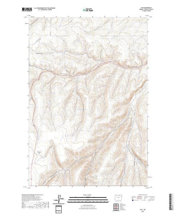
2023 Map of Nye
USGS Topo · Published 2023About this map
Whittaker Flats and the deep incisions of Rugg Canyon characterize this portion of Umatilla County, where the high plateaus of eastern Oregon are carved by a dense network of seasonal drainages and springs. The landscape is defined by its water sources, from the named flows of Bear Creek and West Birch Creek to vital points like Stewart Spring and Middle Rugg Spring. This rugged topography has dictated a sparse transportation network, primarily consisting of county roads such as Yellow Jacket Rd and the prominent corridor of Highway 395. The nomenclature of the area, including Schoolhouse Canyon and Windmill Canyon, hints at a history of remote homesteading and the essential infrastructure required for ranching and settlement in this semi-arid environment.
Find a feature on this map
30 named features on this map. Tap any name to fly to it.
Don’t see what you’re looking for? This feature index may not catch every label — zoom into the map to look around manually.
Map Details
Editions of this 2023 Nye Map
This is the sole edition of this map. No revisions or reprints were ever made.
Other maps of this area

1908 · Umatilla
USGS Topo · 1:125,000

1935 · Pendleton
USGS Topo · 1:125,000

1953 · Pendleton
USGS Topo · 1:250,000

1956 · Pendleton
USGS Topo · 1:250,000

1966 · Mc Kay Reservoir
USGS Topo · 1:24,000
1966 · Coombs Canyon
USGS Topo · 1:24,000

1967 · Nye
USGS Topo · 1:24,000

1967 · Granite Meadows
USGS Topo · 1:24,000

1967 · Carney Butte
USGS Topo · 1:24,000

1967 · Pilot Rock
USGS Topo · 1:24,000