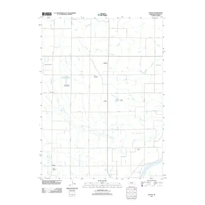
2011 Map of Nysted
USGS Topo · Published 2011About this map
Nysted and the surrounding plains of Howard County are defined by a rhythmic grid of rural roads and the meandering path of the Middle Loup River. This agricultural landscape preserves a distinct ethnic heritage through its many burial grounds, including the Czechoslovakia Cemetery, Saint Wenceslaus Cemetery, and Warsaw Cemetary. These names reflect the Central European and Scandinavian settlement patterns that established this portion of Nebraska. The terrain is irrigated and drained by complex systems, including Turkey Creek and Oak Creek, while modern infrastructure is represented by the Jacobs Waste Treatment Reservoir and Jensen Reservoir. Small collection points like Midway sit at section intersections, serving the expansive farmsteads that fill the intervals between the river bluffs and the northern plateaus.
Find a feature on this map
33 named features on this map. Tap any name to fly to it.
Don’t see what you’re looking for? This feature index may not catch every label — zoom into the map to look around manually.
Map Details
Editions of this 2011 Nysted Map
This is the sole edition of this map. No revisions or reprints were ever made.
Other maps of this area

1899 · Loup
USGS Topo · 1:125,000

1899 · St. Paul
USGS Topo · 1:125,000

1953 · Dannebrog
USGS Topo · 1:24,000

1953 · Cotesfield
USGS Topo · 1:24,000

1953 · Boelus
USGS Topo · 1:24,000

1953 · Farwell
USGS Topo · 1:24,000

1953 · Nysted
USGS Topo · 1:24,000

1953 · Elba
USGS Topo · 1:24,000

1955 · Broken Bow
USGS Topo · 1:250,000

1955 · Wolbach SW
USGS Topo · 1:24,000