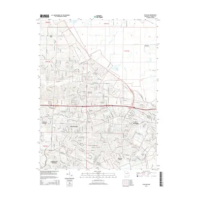
2015 Map of O'Fallon
USGS Topo · Published 2015About this map
O'Fallon and St. Peters anchor this heavily developed portion of Saint Charles County, where suburban expansion meets legacy landmarks. The landscape is defined by the winding paths of Peruque Cr and Belleau Cr, which drain toward the northeast. Institutional and religious history is prominent, with sites like the Sisters of the Most Precious Blood Cemetery and Assumption Cemetery providing deep roots for local genealogists. The map also captures the educational footprint of the area, featuring the Vatterott College-O'Fallon Campus and the St Charles Community Coll. To the north, the transition from dense residential blocks to more open land is marked by the private Waldmeister Farm Airport and small water bodies such as Schulte Lake and Lharky Lake.
Find a feature on this map
269 named features on this map. Tap any name to fly to it.
Don’t see what you’re looking for? This feature index may not catch every label — zoom into the map to look around manually.
Map Details
Editions of this 2015 O'Fallon Map
This is the sole edition of this map. No revisions or reprints were ever made.
Other maps of this area

1903 · O'Fallon
USGS Topo · 1:125,000

1931 · Brussels
USGS Topo · 1:62,500

1932 · Manchester NE
USGS Topo · 1:24,000

1937 · Weldon Spring
USGS Topo · 1:24,000

1939 · Brussels
USGS Topo · 1:62,500

1940 · Weldon Spring
USGS Topo · 1:24,000

1941 · Troy
USGS Topo · 1:62,500

1943 · Brussels
USGS Topo · 1:62,500

1945 · Troy
USGS Topo · 1:62,500
1947 · Chesterfield
USGS Topo · 1:24,000