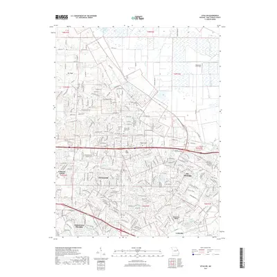
2017 Map of O'Fallon
USGS Topo · Published 2017About this map
O'Fallon and the surrounding Saint Charles County landscape show the results of rapid suburban integration in this 2017 survey. The map records a dense network of residential developments and commercial corridors such as E Terra Ln and Mexico Rd, which have largely bridged the gap between established centers like St. Peters, Lake St. Louis, and Cottleville. Despite this growth, older community anchors remain visible, particularly through religious and genealogical sites including the Sisters of the Most Precious Blood Cem, Assumption Cem, and Sage Chapel Cem.
Find a feature on this map
55 named features on this map. Tap any name to fly to it.
Don’t see what you’re looking for? This feature index may not catch every label — zoom into the map to look around manually.
Map Details
Editions of this 2017 O'Fallon Map
This is the sole edition of this map. No revisions or reprints were ever made.
Other maps of this area

1903 · O'Fallon
USGS Topo · 1:125,000

1931 · Brussels
USGS Topo · 1:62,500

1932 · Manchester NE
USGS Topo · 1:24,000

1937 · Weldon Spring
USGS Topo · 1:24,000

1939 · Brussels
USGS Topo · 1:62,500

1940 · Weldon Spring
USGS Topo · 1:24,000

1941 · Troy
USGS Topo · 1:62,500

1943 · Brussels
USGS Topo · 1:62,500

1945 · Troy
USGS Topo · 1:62,500
1947 · Chesterfield
USGS Topo · 1:24,000