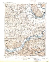
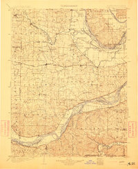
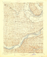
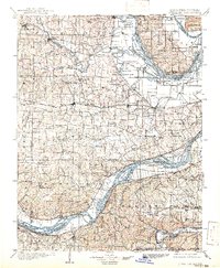
1903 Map of O'Fallon
USGS Topo · Published 1944About this map
The Mississippi River and Missouri River converge in this late nineteenth-century survey, creating a complex landscape of fertile river bottoms, islands, and chutes. Between these two great waterways, the terrain is defined by the Cuivre River and a network of creeks like Dardenne Creek and Peruque Creek. Transportation at the turn of the century centered on the Wabash R. R. and the St. Louis and Kansas City Line, which connected growing agricultural hubs such as Wentzville, O'Fallon, and St. Peters.
Find a feature on this map
131 named features on this map. Tap any name to fly to it.
Don’t see what you’re looking for? This feature index may not catch every label — zoom into the map to look around manually.
Map Details
Editions of this 1903 O'Fallon Map
5 editions found
Other maps of this area

1890 · Louisiana
USGS Topo · 1:125,000

1890 · Hermann
USGS Topo · 1:125,000

1901 · De Soto
USGS Topo · 1:125,000

1903 · O'Fallon
USGS Topo · 1:125,000

1903 · Sullivan
USGS Topo · 1:125,000

1912 · Kimmswick
USGS Topo · 1:62,500

1916 · Kimmswick
USGS Topo · 1:62,500

1924 · Robertson
USGS Topo · 1:24,000

1927 · St. Charles
USGS Topo · 1:62,500

1930 · Hardin
USGS Topo · 1:62,500