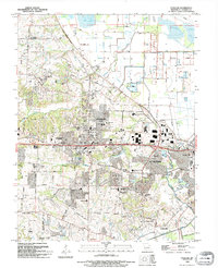
1994 Map of O'Fallon
USGS Topo · Published 1995About this map
O'Fallon and St Peters are the primary centers of development in this mid-1990s look at eastern Missouri. The map illustrates a landscape in transition, where established residential sectors like All Saints Village and Cottleville meet expanding institutional footprints. This is particularly evident in the concentration of educational and religious sites, such as St Marys College, Boonslick State Sch, and the Church on the Rock.
Find a feature on this map
51 named features on this map. Tap any name to fly to it.
Don’t see what you’re looking for? This feature index may not catch every label — zoom into the map to look around manually.
Map Details
Editions of this 1994 O'Fallon Map
This is the sole edition of this map. No revisions or reprints were ever made.
Other maps of this area

1903 · O'Fallon
USGS Topo · 1:125,000

1931 · Brussels
USGS Topo · 1:62,500

1932 · Manchester NE
USGS Topo · 1:24,000

1937 · Weldon Spring
USGS Topo · 1:24,000

1939 · Brussels
USGS Topo · 1:62,500

1940 · Weldon Spring
USGS Topo · 1:24,000

1941 · Troy
USGS Topo · 1:62,500

1943 · Brussels
USGS Topo · 1:62,500

1945 · Troy
USGS Topo · 1:62,500
1947 · Chesterfield
USGS Topo · 1:24,000